UPDATE (1/6/25) 3:10 p.m.:
Due to “challenging road conditions,” all schools in the WSD will be closed for Tuesday, Jan. 6.
UPDATE (1/6/25) 11:12 a.m.:
After almost 48 hours of constant snowfall, the total range of snow varied throughout the St. Louis area.
The snow stopped at around 5 a.m on Monday, Jan. 6 in the Lake Saint Louis area. Lake Saint Louis got some of the most snowfall in the area with up to 9 inches of snow. Other areas such as Kirkwood, Harvester, and even the St. Louis Lambert airport got anywhere between 6-6.5 inches of snow. Bowling Green had the highest snowfall total amount with around 10 inches of snow.
Temperatures are expected to remain below freezing all the way up until the weekend. This means that any snow and/or ice on the ground will not be capable of melting.
Salt is capable of working pretty well even in road temperatures of 15-25 degrees. But anything below that 15 degrees makes road salt nearly ineffective.
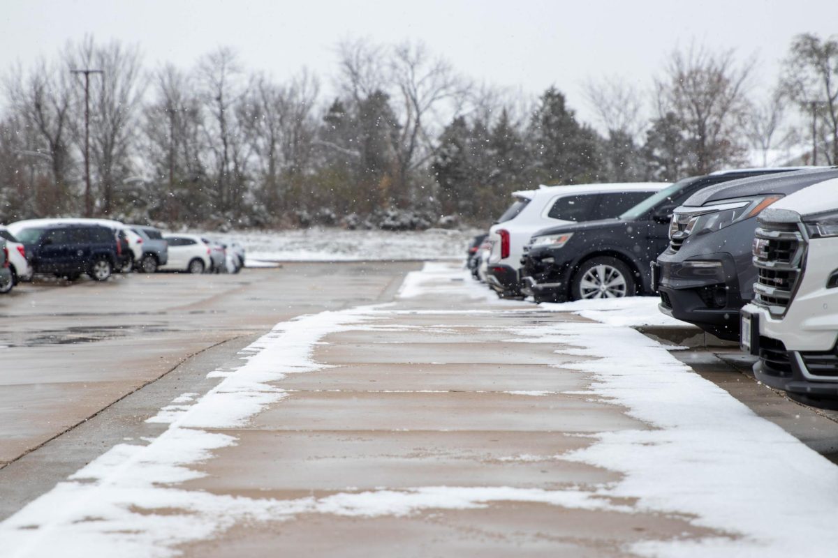
The freezing temperatures make it very difficult to clear sidewalks and even parking lots.
As of now, the WSD maintenance staff is working hard to clear sidewalks and parking lots efficiently for the safety of students and faculty members.
MONDAY SCHOOL CLOSURE (1/5/25):
As the first day back from break approaches, a winter storm also approaches.
A winter storm was reported on future radars beginning around Dec. 31. The radars put the St. Louis area in a range anywhere from 9-12 inches of snow.
Those predictions became reality late Saturday night and into Sunday with snow and sleet pelting the area all day leading districts across the St. Louis area, including the Wentzville School District, to cancel school for Monday.
“I’m excited we get an extra long break do to the storm,” Kaylee Strassmeier (10) said.
The National Weather Service expected this storm to hit the STL area around 10 p.m on Saturday, Jan. 4.
The slow moving storm picked up throughout the night, leaving up to a quarter of an inch of ice on the roads going into the morning of Jan. 5.
In preparation of this storm, the WSD planned out specific routes to take to insure and inspect the safety of the roads.
“There are specific people who go out and determine whether it is safe or not for students to travel to school,” WSD administrative assistant Debbie Sethaler said.
Superintendent, Dr. Brian Bishop is specifically assigned to drive and inspect the roads around Liberty High School. While other administrators in the District office drive other routes for other schools in the district.
After each road is inspected, the administers make an overall decision of the school closures.
Throughout the day of Jan. 5, this team looked over the roads carefully and ultimately deemed them unsafe to drive in. Although school doesn’t start back up until Jan. 6, the snow and inclement winter weather is expected to continue up until 6 a.m going into the morning of Jan. 6. With this in mind, the decision of the closure was a confident answer.
The National Weather Service has been sending out frequent alerts due to the severity of this storm.
According to the National Weather Service, this storm could have a significant threat to life or property. The NWS explains that this storm is brining heavy mixed precipitation with additional snow and sleep accumulations between 4 and 12 inches and ice accumulations around one tenth of an inch.
This winter storm has impacted portions of south central and southwest Illinois and central and east central Missouri, which includes the STL area.
The NWS recommends not to travel during this storm and is could be very difficult to impossible to travel in. The NWS also states that the hazardous conditions could impact the Monday morning commute.
As the winter weather continues, the WSD will be sure to keep a close eye on the storm for future closures.
This snow day is the first one for the WSD. The district adjusted their snow day policy this year. After the first two snow days, the district will move to Alternative Methods of Instruction (AMI) days for day 3 -7.


